
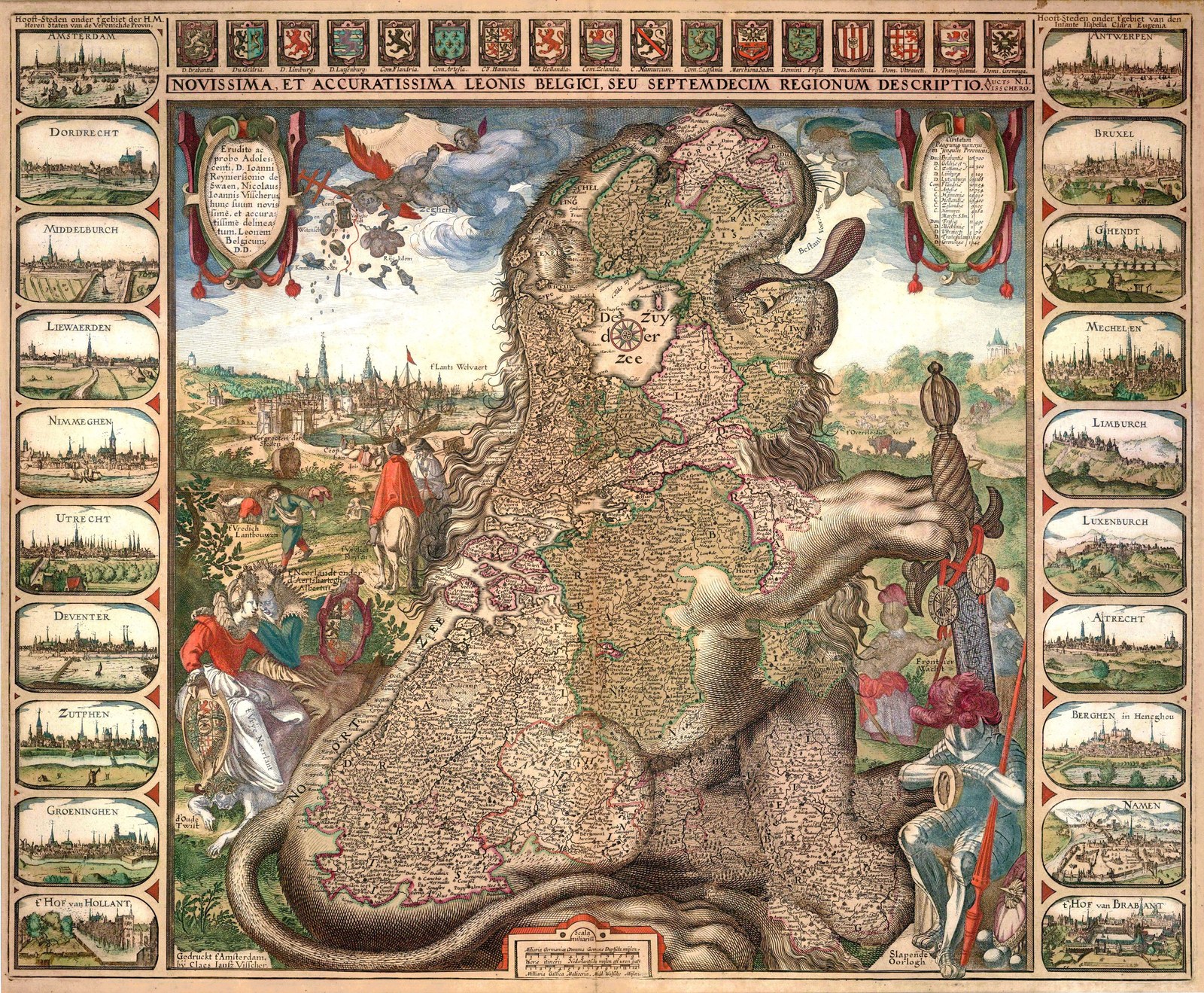
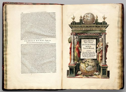
Map art describes maps made or valued as much for their visual craft as their geographic accuracy, produced by hand on vellum or paper with pen, ink, and watercolor, or engraved onto copper plates for printing. Cartographers filled uncertain or unexplored regions with decorative devices: elaborate title cartouches, compass roses marked with rhumb lines, sea monsters and ships in open ocean, and allegorical figures representing continents or winds. Coastlines and borders were often hand-colored after printing, using thin watercolor washes applied within engraved outlines. Lettering combined careful calligraphy for place names with larger decorative script for titles. Materials shifted over centuries from hand-copied vellum manuscripts to copperplate-engraved and later lithographed sheets, bound into atlases or sold as large wall maps. The genre sits between science and ornament: even maps drawn for navigation were routinely dressed up with gilt borders and imagined creatures.
What defines the medium
The cartouche
A decorative panel, often framed with scrollwork, figures, or foliage, holds the map's title, maker's name, and sometimes a dedication. Cartouches were treated as miniature artworks in their own right, filling blank corners.
Compass rose and rhumb lines
A star-shaped compass rose marks the cardinal directions, radiating straight rhumb lines across the map to help navigators plot a bearing. On decorative maps the rose itself became an ornate centerpiece rendered in ink and gold.
Hand-applied color washes
After a map was printed from an engraved plate, colorists applied thin watercolor washes by hand within the printed outlines to mark borders and territories, so identical prints could have individually varied coloring.
Filling the unknown with imagery
Regions that were unmapped or unexplored were rarely left blank. Cartographers filled them with sea monsters, ships, or wind-blowing figures, turning uncertainty into decorative content rather than empty space.
Engraved copperplate line work
Fine detail—coastlines, hatching for terrain, small building icons for towns—was cut into copper plates with a burin, producing crisp, consistent lines that could be printed repeatedly before the plate wore down.
Scale, legend, and orientation
Maps include a scale bar for distance, a legend explaining symbols, and often place north at the top, though older maps sometimes oriented east or toward a culturally significant direction instead.
Materials decoder
The toolkit of map art
- compass rose
- → an ornate star marking direction, often the most decorated single element on a historic map
- cartouche panel
- → a scrolled frame holding the map's title and maker's name, often the most illustrated part of the sheet
- sea monster or ship vignette
- → decorative creatures or vessels filling open ocean areas beyond known coastlines
- hand-colored wash
- → thin watercolor applied by hand over a printed outline, giving each copy slightly different coloring
- engraved hatching
- → fine parallel or crosshatched lines cut into copper plate to suggest mountains, shading, or terrain
- rhumb lines
- → straight lines radiating from compass points across a chart, used historically to plot a ship's bearing
The story
Map art descends from practical surveying and navigation records that were also treated as prestige objects. Medieval European mappae mundi, such as the Hereford Mappa Mundi made around 1300, combined geography with religious and moral symbolism rather than accurate scale. Portolan charts drawn on vellum by Mediterranean navigators from the 13th century marked coastlines and compass bearings in fine detail. The Age of Exploration brought landmark printed maps, including Martin Waldseemüller's 1507 world map, the first to label the Americas, and Gerardus Mercator's 1569 projection, still used as the basis for many modern world maps. Dutch publishing houses such as the Blaeu family produced lavishly illustrated atlases in the 17th century. As survey technology made maps more scientifically precise in later centuries, decorative elements declined, though antique maps remain widely collected as art objects today.
Masterpieces of the medium
| Work | Artist | Date | Why it matters |
|---|---|---|---|
| Hereford Mappa Mundi | Unknown | c. 1300 | large medieval world map on vellum combining geography with religious symbolism |
| Universalis Cosmographia | Martin Waldseemüller | 1507 | the first printed world map to label the newly encountered Americas |
| World Map (Mercator Projection) | Gerardus Mercator | 1569 | introduced the projection still used as a basis for navigational and reference maps |
| Ebstorf Map | Unknown | c. 1234 | monumental medieval mappa mundi destroyed in 1943 and known today through photographs |
| Atlas Maior | Joan Blaeu | 1662 | an eleven-volume atlas from Amsterdam filled with hand-colored, richly decorated maps |
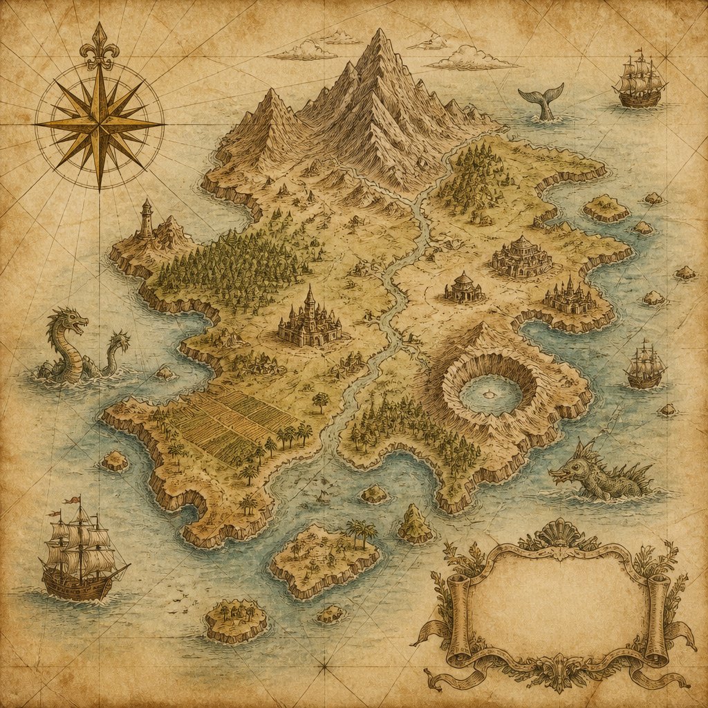 AI-generated
Try the medium
Try map art with AI
This example was generated from a prompt like: “An antique-style illustrated map on aged parchment, ornate compass rose with rhumb lines, a scrolled cartouche title panel, small sea monsters and sailing ships in the ocean, sepia ink and faded watercolor coloring.”
Open the Map Art Style generator →The medium today
Antique maps are widely collected, reproduced, and displayed as decorative art, with original hand-colored sheets from historic atlases sold individually by print dealers. Digital tools now let designers generate illustrated or stylized maps that borrow the visual language of historic cartography—cartouches, compass roses, aged paper texture—for book covers, fantasy worldbuilding, and home decor. Museums and libraries have digitized major historic map collections, making high-resolution scans of centuries-old originals freely available for study.
Compose your own
Making map art starts with a base outline, hand-drawn or traced, of real or invented coastlines and borders. Add a compass rose in one corner, oriented and detailed with rhumb lines radiating outward, then draft a cartouche for the title using scrollwork or a decorative frame. Fill unmapped or ocean areas with small illustrated elements—ships, sea creatures, or wind figures—rather than leaving them empty. Ink work benefits from a fine-nibbed pen for coastlines and place names, followed by thin watercolor washes for borders. Aging the paper with tea staining or a texture overlay and using a serif or calligraphic typeface for labels completes the antique cartographic look.
Frequently asked questions
Why do old maps have sea monsters drawn on them?
Cartographers filled unexplored ocean regions with imagined creatures and ships partly as decoration and partly to signal danger or the limits of known geography, turning uncertainty into engaging visual content.
What is a cartouche?
A cartouche is the decorative frame, often scrolled or figured, that holds a map's title, maker's name, or dedication. It functioned as a miniature artwork within the larger map.
How were old maps colored?
Most were printed in black ink from an engraved plate, then hand-colored afterward using thin watercolor washes applied within the printed lines, which is why identical printed maps can show different coloring.
Are historic maps accurate?
Accuracy varies widely. Portolan charts and later surveyed maps were often precise for their time, while medieval mappae mundi prioritized symbolic and religious meaning over geographic correctness.